Showing posts with label history. Show all posts

Tuesday, October 28, 2008

A Band of Gypsies

They didn’t have much, if any impact on Jefferson County, and they may have left no descendants in the area. But a band of gypsies that settled in Hanover by 1860 got more than their share of stories published about their brief sojourn in Jefferson County.


The group showed up in the town of Hanover when 81 persons identified in the 1870 census were shown as gypsies. They carried the surnames: Green, Youngs, Woods, Reynolds, Knobbs, Smythes and Bofo and included some distinct first names, such as Whyte Youngs and Pablo

Youngs. Thirty-seven bore the Young/Youngs surname and 12 were Greens.


The 1860 Jefferson County census doesn’t shown the surname Stanley, even though several sources show that Owen Stanley, reportedly the Gypsy King (there were probably many of them) and died in his wagon near Madison on Feb. 21, 1860 in his sixty-seventh year. There were supposed to be 200 in this group so the rest must have left by 1870.


Stanley was born in Reading, Berkshire, England, and his body was taken back to the Woodland Cemetery near Dayton, to be buried next to his wife, Harriet Warden, who died on Aug. 30, 1857, age 63. That's according to the History of Dayton and Montgomery County, Ohio, published in 1909, whose author found their tombstones. This book claims Woodland was the first gypsy cemetery in the United States, but that’s one of those claims that should be immediately questioned.


T
he group appeared to have arrived at Dayton in 1856 from Canada (where they can't have stayed long), moved on to Indiana quickly, and most moved on quickly again. The best evidence of their emigration date comes from a transcribed tombstone in the cemetery that showed: “ daughter of Mary,Dangefo and Dovie Stanley; born in England, died December 11th, 1857, aged two years and fourteen days," …

The publications talking about them were kind, compared to some of the comments made about gypsies. Part of this seems to have been racial--the Stanleys were far more European looking than some of their darker brethren.

Owen Stanley
was succeeded as king by his son Levi Stanley, whose wife Matilda became queen. There is no indication they came to Indiana with the rest of the tribe and were shown in Troy, Miami County, Ohio, in 1860. There were 25 people shown as wanderers in Troy. The 1880 census shows none of these families remaining In Indiana--they apparently came together and left together.

Monday, June 9, 2008

Madison's First Burials--the Springdale Myth

There’s a large stone at the entrance to Madison’s Springdale Cemetery bearing the date 1810. Unfortunately, it has nothing to do with the date the cemetery was established.

Because, even if there may have been some burials in the plain before Springdale was established in 1839, the person who was supposedly buried there in 1810 wasn’t even born until 1824.

The claim is that Fanny Sullivan who died in 1810 was the first known burial. However, this Fanny’s identity is well known—she was the teenage daughter of noted Madison lawyer Jeremiah Sullivan. In fact, when the DAR published in Jefferson County Cemetery transcriptions in 1941 it showed the following: “Sullivan, Francis E., May 2, 1824 - Oct 7, 1839, d/o Jer. & C.R. Sullivan”

In a letter published in the Courier of April 21, 1879, Richard C. Meldrum, a former Madison, gave a string of reminiscences in which he mentioned “the first burial in Springdale Cemetery (Fanny Sullivan), a sweet young girl… “ (Meldrum was born about 1821/)

Former Madisonian Ruth Hoggatt put together a solid list of facts about the land’s history. These included a deeded dated Nov. 28, 1848, between Milton Stapp and wife Elizabeth and the city of Madison which noted the city had completed payment under a bond dated 1838 and that the east side of a tract set off to Stapp had been conveyed to the City.

Certainly, the 1839 date was recognized local. In the Madison Courier of June 2, 1859, a paragraph transcribed by Ms. Hoggatt noted: "Springdale Cemetery was purchased and located in 1839, almost twenty years ago. Mr. Grayson, the sexton, informs us that there have been buried in the twenty years in Springdale three thousand three hundred and thirty-two bodies — about one-third of the present number of the inhabitants of the city."

The date was again reported later in the 1800s. One of the more interesting accounts in the newspapers attributed to Fanny the statement that she believed she would be the first period buried there.

There certainly is a possibility there were burials on the Springdale side of Crooked Creek before the cemetery was formally organized. Many church cemeteries in Jefferson County, for example, grew out of family cemeteries that preceded the founded of the religious bodies.

The DAR transcription of Springdale burials, published in 1941, shows a Jozebad Lodge (1767-1830), buried there. But the transcription shows no other death date inscriptions from the 1820s and only a handful in the 1830s earlier than 1839.

Where was the first burial in Madison? In an account published in the Madison Courier in 1874, James Lewis said that before the Third Street Cemetery (now the site of John Paul Park) was established in 1817, "the burying ground was up in Fulton, above Greiner's Brewery." Fulton, which was briefly an separate town bordering Madison on the East at Ferry Street, was also cited by an author identified as "The Wanderer" in a series of reminiscences published in 1889. He cited the first burial as a Mrs. Slack who was buried, "in the pioneer graveyard on the bank of the town near the corner of Ferry Street in what is now Madison.”

Friday, February 22, 2008

John Brough: More than Folly

John Brough was a very busy man. It’s not just that he was running the Madison & Indianapolis Railroad, and preparing to make his name a symbol of failure with the construction of Brough’s Folly, the attempt to run the railroad through what is now Clifty Falls Park.

No, Brough (pronounced Brough) was very busy because he was running more than one railroad company while he lived in Madison and headed the M&I.

In 1851, Brough attempted to get a charter for the Atlantic & Mississippi Railroad, which was to run from Terra Haute to Saint Louis via Vandalia. That was denied after $500,000 was subscribed; another charter application was denied in 1853. In fact, the account, published in 1884 in the book, "Counties of Cumberland, Jasper and Richland Illinois" says he tried and tried, but was always denied. One of these efforts was apparently the Terra Haute and Saint Louis Railroad, whose board elected him as president, sometime before an account was published, also in 1851. An Illinois history said he tried to pursue the line, despite the lack of sanction of law. Illinois kept him from building any line.

That determination, and his physical appearance, were well known. After the train engine, the John Brough, arrived in Madison on May 10, 1850, the next day’s Madison Courier commented, We are told this engine is called the John Brough on account of its great weight and for the great amount of business it is capable of doing.”

The weight made itself known in his life as a politician, in the following verse.

“If all flesh is grass, as people say

Johnnie Brough is a load of hay.”


And there was a joke, when he challenged Madison’s Michael Bright to a dual that Bright would have been at a disadvantage because the bullet would have trouble penetrating Brough.


His energy did not come from clean living. One nineteenth century account said he chewed enormous amounts of tobacco, was never very clean in his personal appearance, and “Did not believe in prohibitory laws and could not be labeled as an exemplar of any particular purity.”


His joint railroad jobs contrasted with the fact that the M&I board hired a superintendent under his predecessor, Samuel Merrill, holding that the two positions were too much for one man. Apparently, Brough was in a different category.

Brough left Madison in 1853 to take over the Bellefontaine & Indianapolis Railroad (which he may have had his hand in before leaving), and was still at work in his other Iron Horse ventures.

Whatever his capability in railroads, give him credit as a politician. As a vigorous pro-Union War governor of Ohio, he ensured that state stayed strong in the fight.

Brough came close to leaving his name on another map. The town of Effingham, Ill., was originally paired with one named Broughton, but that name was abandoned and the towns merged as Effingham since Brough wasn’t terribly popular.

Well, it could have been worse in Indiana. Madison could have been named Broughton

Monday, February 18, 2008

Madison's Richest Man

Ask anyone familiar with Madison in the 1800s to name the city’s richest man and the answer would probably be James F.D. Lanier.

The Lanier Home symbolizes his wealth and he was possibly the wealthiest person to have lived in Madison and Jefferson County during the Nineteenth Century. But he was probably never the richest person while he lived in the city.

The 1850 census was the first tally reporting financial information about individuals, giving the value of real estate holdings. The census showed Lanier’s real estate had a value of $90,000, but this did not include stock holdings.

Still, the wealthiest Madison residents in 1860 were probably two land-rich widows, Anna Paul Hendricks, daughter of Madison’s found John Paul and widow of the late Sen. William Hendricks, and Eliza McIntyre, widow of Madison developer John McIntyre (or McIntire), which reflects the wealth that their husbands had during their lifetimes.

The Madison Courier of Sept. 9, 1851 listed John McIntire’s heirs at the top with $236,100 in property, followed by Hendricks’ heirs with $136,760. Ranking No. 3 was Michael Bright, followed in order by John Woodburn, Jesse Whitehead and Lanier. However, this didn’t include stock holdings. Lanier would have needed a lot of stock to come out at number No. 1.

Michael Bright, older brother of the well-known Senator Jesse Bright, grew significantly richer, with $90,000 in real estate and $50,000 in personal property in 1860, with diverse holdings. There were shown around 1850 by his appeal of city taxes. A Madison City Council record showed the council agreed that he owned $2,250 of Madison & Indianapolis Railroad stock, not the $4,750 he was originally taxed. This apparently stemmed from Bright’s briefly leaving Madison, and not being a resident. But the council held he was properly taxed on $30,450 in state stocks as he had re-established residency in December 1850.

Whitehead is rarely mentioned in local histories, but he lived in Madison about as long as Lanier. One account said he originated the state’s banking system and it’s possible he and Lanier should share credit. He also reportedly pioneered Madison’s river boat industry. His wealth grew sharply from 1850, when the census showed he had $17,000 in real estate. The 1850 Madison tax assessor’s list showed Whitehead were $20,017 of railroad stock, $19,320 in Madison bank stock and $15,000 in Indianapolis bank stock.

By 1860, Whitehead was clearly No. 1 with $355,000 in real estate and $14,275 in personal property. No one else was close. Michael Bright had $90,000 in real estate and $50,000 in personal property, according to the 1860
Madison census.

Lanier, who was already a part-time resident in 1850, had $250,000 in real estate and $250,000 in personal property, according the 1870 census for New York County (Manhattan.) Whitehead, living in Chicago, had retired and his holdings had fallen to $150,000 in real estate and $4,000 in personal property.

Wednesday, February 6, 2008

First Visitors: Pushing Back County History

Who was the first European to visit Jefferson County and when? The answer usually given is George Logan in 1801. But exploration started the middle of the eighteenth century and perhaps earlier.

A crudely drawn map, referred to as the Trader’s Map, usually dated to 1753, shows a stream entering the Ohio at the right place for the Indian-Kentuck Creek. The creek that enters the Ohio River at Brooksburg. In 1778, Thomas Hutchens produced a more carefully drawn map which shows lines of latitude and longitude and shows what is almost certainly the Indian-Kentuck, although no streams were named. Given the map’s accuracy, someone must have gone up the creek to chart it.

The Indian-Kentuck became the first geological feature in Jefferson County to get an English name, when it appeared on John Filson’s first map of Kentucky, Drawn in 1784, and published in 1793, the stream was the only one on the Ohio river’s north shore between Cincinnati and Louisville to have a name.

The name was also used in an ordinance adopted by Congress on May 3, 1786, which establishing the creek as the western boundary of land to be surveyed. As Indian-Kentucky, it appeared again when a retired French General Victor Collot floated down the Ohio on a spying mission, and passed the area sometime after March 21, 1796, when his voyage began in Pittsburgh. Collot referred to three creeks between the Indian-Kentuck, which were not Hutchens’ map, implying that the Indian-Kentuck Creek was.

The name’s origin was explained by two visitors to the area, Fortescue Cummings, who toured the Midwest from 1807 to 1809, and David Thomas, who visited Madison 1816. Pioneers gave names to streams on the northern side of the Ohio by adding the words Indian in front of names of streams on the south side. So Wheeling Creek, Short Creek, and the Kentucky River, which flowed north, had counterparts called Indian Wheeling Creek, Indian Short Creek, and Indian-Kentuck Creek, which flowed south.

Europeans continued to visit the area with Kentucky settlers and Indians exchanging raids that brought them on the Indian side, opposite the mouth of the Kentucky River. One account identifies a settler named McMullen who was captured on the Indiana side on Feb. 13, 1790.

We can put another name to visitors the next year when General Charles Scott led 752 mounted men north to find Indians. Scott crossed the Ohio on May 23 and 24, 1791 at a place that was described as opposite the mouth of Battle Creek, five miles below the mouth of the Kentucky River. While the name is no longer used, a 1795 map shows that Battle Creek was the earlier name for Locust Creek in Trimble County.

Two years later, teenagers John and Peter Smock were captured by Indians in Shelby County, Ky., about 1793. The settlers pursued the Indians, who camped for three days on the site where the Jefferson County courthouse now stands, according to an 1874 account by their nephew John Smock.

A few years later, Indians complained to Gov. William H. Harrison that Europeans crossed the Ohio in search of game from the mouth of the Kentucky to the Mississippi and were depleting the Indians’ food. In a letter written in July 1801, he noted these expeditions occurred every fall.

So by the time George Logan carved his named into a tree near Hanover in 1801, a lot of European feet had set foot in Jefferson County.

Aid and Comfort to the Enemy

Sometime during the first half of 1861, the steamboat, the “Masonic Gem,” began sailing a regular route between Madison and Louisville under a permit issued by the military authorities, who were regulating Ohio River traffic.

But the permit was fraudulent, while the ship was “heavily laden with provisions destined for the Confederacy,” according to the Cincinnati Daily Gazette of June 17, 1861. It was a brief episode, since its operations were made public. But illegal traffic from Madison was a problem throughout the War.

Part of this could have been war profiteering, in which participants take only the side of the most money.

For example, soldiers blew the whistle on one scam. According to a soldier from Vevay, in an account printed in the Vevay Reveille of Aug. 29, 1861, five cavalry companies left Madison on five boats on August 26. There were supposed to be six, but the writer claimed that and Col. Wharton and Bob Lodge of Madison tried to cut corners.

The soldier’s letter alleged the two, responsible for feeding and transportation, wanted to cram the men into four vessels, rush them to Pittsburgh without supplies or cooking facilities, charge the government for six watercraft, and pocket the profits. However, junior officers blew the whistle and supplies and five boats were provided.

While there’s no need to recount in detail here that Madison-resident, Senator Jesse Bright, owned slaves in Kentucky, the city had its share of Southern sympathies, if not actual sympathizers. The well-known writer William Woollen termed Madison a “quasi-southern city,” which is emphasized by the plantation mansion appearance of J.F.D. Lanier’s home (even though he was a stout Unionist.)

The commercial connection was strong. According to a 1903 account detailing the history of Methodist Churches in Madison, “Residents choose sides, in many cases, according to their financial interests. Flour, pork, lard, and hay had found ready sale down South and very naturally pecuniary interests were paramount to patriotism, and most of the citizens connected with the flat-boat or steamboat interests were Southern sympathizers.”

How many actually aided the South is not known. But the Louisville Democrat, as quoted in the Reveille of June 30, 1861, outlined a plan under which hundreds of barrels of bacon and pork were to be diverted to the south. These barrels were shipped under the name of Madison’s Powell, McEwen & Co., whose name was replaced with that of Guthrie, White & Co.

About the same time, Capt. David, a well-known Madison steamboat man, refused to unload a delivery of pork in Louisville and took it back to Madison after he could not get guarantees that the barrels would stay in Louisville.
Goods weren’t just going downriver. Various newspaper articles reported a brisk trade from Southern Indiana to the south via the Kentucky River.

The Sept. 12, 1861 issue of the Vevay Reveille noted the Madison Courier had reported “It is also alleged that illegitimate shipments from Madison are daily being made.” The Madison Courier of Aug. 29, 1861 noted the North had stationed 200 to 300 soldiers Cedar Lock on the Kentucky River to make sure no boats passed without being searched.

Monday, February 4, 2008

Corruption and the Hoosier Schoolmaster

There have been many attempts to identify characters in the “Hoosier Schoolmaster,” the novel by Edward Eggleston, as specific people in Jefferson and Switzerland Counties.

But no one has claimed someone they knew was Dr. Henry Small, who led the band of thieves and who framed Ralph for theft, or Pete Jones, the corrupt county commissioner who was siphoning off money that was supposed to be spent on care for those in the poor house, like Shocky and Hannah’s mom, Mrs. Thomson. Yet, these less than savory characters provide the dramatic conflict for the work.

George Cary Eggleston, Edward’s brother, taught at the Rykers’ Ridge School before the Civil War and it was his experiences that formed the basis of many episodes in the novel. George Cary wrote about this in his book “Recollections of a Varied Life” in which he quoted his brother.

“I have a mind, Geordie,” he [ Edward] said, “to write a number three story, called ‘Hoosier Schoolmaster,’ and to found it on your experiences at Ryker’s Ridge.”

However, George Cary, known for his book about his experiences as a Confederate soldier, said that Edward was too good a writer to base the characters on specific individuals. He continued that Edward “made one or two personages among my pupils the models from which he drew certain of his characters but beyond that the experiences which suggested the story in no way went into the construction. George Cary got the Ryker’s Ridge job at the age of 16, which places the period at roughly 1855.

It seems clear Edward did use some specific people as the base. George’s Cary’s pupil Charley Grebe, who bears a surname from the area, had thrashed “the master,” as was the threat in the book. Descendants of a branch of the Buchanan family that moved to Illinois cited the Jeams Buchanan of the novel as part of their clan. And Bud Means, whose real name turns out as Israel Means, at the end of the story, was the name of a resident of Craig Township in Switzerland County who was born about 1830, about the right age for the Bud of the book. And he mentions other area families such as the Banta, while the Rev. Mr. Bosaw also bore a Switzerland County surname.

Eggleston frames the villains with a geography that is semi-real, especially when the Ralph Hartsook, the book’s hero, was visiting Pete Jones’ house.

Ralph "remembered that the region lying on Flat Creek and Clifty Creek had the reputation of being infest with thieves, who practiced horse-stealing and house-breaking."

The political corruption was also described in some detail.

Eggleston said the poor house as being in bad repair "for though the commissioners allowed a claim for repairs at every meeting, the repairs were never made, and it would not do to scrutinize Mr. Jones's bills too closely, unless you gave up all hope of re-nomination to office. …" Bill Jones, the poor house superintendent, had threatened to bind out Shocky (for money) because Mrs. Thomson spoke out against him, and Pete Jones, a county commissioner.

The fact that the Joneses were also in cahoots with Dr. Small, suggests Eggleston patterned these events on the way county business was performed. No, Small and Jones probably weren’t based on specific people. But it is clear, this too, was part of the Jefferson County experience.

Tuesday, January 29, 2008

The Naming of Madison, Ind.: A Revisionist Story

The naming of Madison is a very simple story, right? John Paul, who purchased the land for the city's original site, named it after the fourth president, after first calling it Wakefield.

But the big problem is that the name Madison preceded Paul's arrival, as shown in the 1808 edition of the "Navigator," an annual publication by Zadoc Cramer, who reported on the state of navigation on the Ohio River. The 1808 edition noted that, "from the Kentucky [river] thirteen miles above Madison, to Westport, twenty-three miles below, you have free water.” There is little doubt about Madison's location here, given its location described in relationship to the Kentucky River and Westport. There is also a remark by Vevay entrepreneur Jean Jacques Jacques Dufour, whose Day Book recorded a trip to Madison in 1805. And while the location of that Madison wasn't given, it's hard to figure out where else he could had gone, in the time his trip took.

As to the origin of the name, there are two accounts that challenge the generally accepted view that the city took its name from the fourth president.

Exactly when Robert Miller reached the town is not known. His recollections, written by his son, did not list the date. But it was probably before John Paul because when he arrived, he found only two families. Miller believed that one family was named Vawter. The other family, he said, was named Madison.

"The town took its name from this man’s name,” he reported.

Since Jesse Vawter, who settled on the Madison hilltop in the Fairmount area, was the first settler in Madison in 1806, Miller's account rings true.

James Burns, who gave an account of his local recollection of local history in 1873, gave the story twists, not recounted elsewhere. Burns, in a statement that contradicts about everything every written, said, “The first man ever to live in Madison was a Negro named Madison from whom the town got its name.”

The claim has gone unnoticed, probably because when his recollections, first published in a Madison newspaper, were reprinted, the end of the article was omitted.

Technical, Vawter wasn't the first settler in the Madison of the 1800s. The first people on the riverfront anywhere near Madison were William Hall and his son John, who made a clearing sometime from 1806 to 1808,in what later became the town of Fulton. It was John Henry Wagner, a tavern operator, who landed at the foot of modern Jefferson Street on May 8, 1808, who built a house in the original town, on what is now the site of the Schofield house.

It was James Lewis, whose reminiscences who originated the story about Wakefield, and supported the theory that the town was named after the fourth president.

But Burns was born in 1786 while Lewis was born about 1812. Also there is little chance that Miller and Burns came up with the Madison family a common account. Miller stayed in the area only a short time and Burns, who was born 1786 in Virginia, came to Madison in 1814, year after Miller left the area

Burns knew the pioneers as an adult. He ate dinner with John Paul shortly after reaching Madison. He undoubtedly knew Jesse Vawter as he laid out Wirt, where Jesse lived, along with Jesse's son James, and Burn's son Maxa, married Jesse's granddaughter Maria in 1826.

Vevay's Dufour: Smooth Talker

[Editor's Note: While Jean Jacques Dufour lived in Switzerland County, not Jefferson, his activities are of interest to many.]

Give Jean Jacques Dufour credit. The man who founded the Swiss colony on the northern bank of the Ohio River had a way of convincing others to give him what he wanted.

He got the ear of a president, Thomas Jefferson, who could read and answer the letters that Dufour had written in French. He persuaded the U.S. Congress to allow him to buy land at terms not available to others. And he got press coverage that gave his operations the appearance of being far more successful than they really were.

Jean Jacques moved into the public eye after purchasing land in Fayette County, Ky., the so-called First Vineyard. Dufour told a visitor that originally several individuals pledged to raise 10,000 piasters, divided into 200 shares of 50 piasters each, a subscription that was filled. However, traveler Francois Michaux, who visited the Kentucky vineyard in 1802, wrote that Dufour “informed me, that a great number of Swiss had, indeed, had an intention of coming hither, but that as the time for setting off, the greater part of them had changed their opinion, and that the whole colony was reduced to his family and a few friends, in the whole, eleven persons.” Michaux also opined that the results didn't measure up to glowing newspaper reports.

Dufour started on his American venture on March 20, 1796 and spent the next few years buying and selling goods, such up and down the Ohio and Mississippi Rivers and throughout Kentucky, in order to raise money for his dream of an American vineyard.

The difficulties in growing grapes, the lack of interest of the proprietors, is mentioned by this account as a factor in the failure along with "the division of M. Dufour’s family, a part of which was on the point of quitting it to settle on the banks of the Ohio." That, of course, was the origin of the Swiss settlement in Indiana.

To start the Indiana effort, Dufour wrote Thomas Jefferson [in French and English] a woeful tale of five families, all experienced vine keepers, who left Switzerland because of heavy losses of property stemming from war and revolution there. Meanwhile, he had described the First Vineyard in Kentucky as having "the most flattering prospect of complete success."

What Dufour wanted from Jefferson was a simple request of getting Congress to grant him the ability to purchase 2,500 acres in what would become Switzerland County at two dollars per acres, to be paid in 1812, ten years later. This compares to everybody else who, before 1820, got three years to pay. Not only would the vineyard be a valuable form of agricultural, but Dufour assured the president "that the land which your petitioner wishers to purchase can only be useful to cultivation of the vine …" that except for a small piece on the river "… being either abrupt hills or deep valleys, and such as in all probability would not sell before the period contemplated for the payment to be made by your petitioner."

That last statement would probably have come as a surprise to people like the Picketts, who were squatting on the land, and who were displaced when Dufour and his associates claimed it.

Congress went along with this deal. Then, Dufour got stuck in Europe during the War of 1812, with payment due in 1814. So he petitioned Congress for another five years to pay. He got that. But when 1818 rolled around and he was asked for 12 months to pay because the government was requiring payment in coins, not notes, part of Congress rebelled. A committee of the House of Representatives split 7 to 7 on the bill and in December 1818, the House rejected the bill by a vote of 65 to 66 on a third reading.

Somebody must have twisted some arms because the bill came up again on December 23, 1818. The official record noted, "The debate was more animated than at the first glance one would have expected such a question to produce." It was spirited enough that it lasted past the usual time for adjournment.

Dufour finally got his way when it passed by a vote of 73 for and 67 against with the record noting that, "The bill was opposed on the general grounds of the inexpediency of making a discrimination between these claimants and other petitioners."

While the congressional records show no final vote, Dufour paid since he got title to the land. Of course, the final kicker to all this is that he wasn't required to use it for growing grapes, so to a certain extent, the Dufours were given 15 or so years to pay for an investment in real estate that they then sold to other settlers.

The Old, Old Indian-Kentuck

The name Indian-Kentuck Creek is distinctive—no other stream in the United States bears the name. More commonly called the Indian-Kentucky Creek in the nineteenth century, it was the first geographical feature in Jefferson County to receive a European name.

There have been a variety of theories about the name's origin.

One was reported in the 1884 obituary of Elisha Short. Short, who came to what is now Milton Township with his father Short in 1810, claimed his father applied the name because there were "nothing but Indians and Kentuckians living there." But there were few Indians and fewer Kentuckians in the area in 1810. And the name is much older.

The Indian-Kentuck's route may have appeared on a crude map, known as the Trader's Map, dated 1753, which shows an unnamed stream on the Indiana side of the Ohio Rover, just downstream from the mouth of the Kentucky River, and in the right spot in relation to other (also unnamed) streams on the map to be the Indian-Kentuck.

A far more accurate map drawn, by Thomas Hutchins and published in London in 1778, shows a 20-yard wide stream in the right place in relationship to the modern lines of latitudes and longitude and known streams. The drawing accurately depicts the creek's main branches along its course in eastern Jefferson County.

The first known use of the name came on May 3, 1786 when the Continental Congress adopted an ordinance describing the survey of "the tract of Territory lying upon the river Ohio, between the little Miami and Indian Kentucky inclusive..."

But the name was probably in use even earlier. Drawn in 1784, but not published until 1793, John Filson's map of Kentucky, which shows Southern Indiana as well as Kentucky, clearly labeled as stream as the Indian-Kentucky Creek

The name appeared several maps published in the 1790s and the first decade of the 1800s, several based on Hutchins fine work. Sometimes the name Indian-Kentucky was applied to what is now called the East Prong, sometimes to Brushy Fork. At other times, the name West Fork, the second county feature to receive an English name, was applied to the branch that still carries the name.

In 1796, Henri Collot, a French general on a spying mission, wrote in his diary that he passed the Indian-Kentucky Creek as he drifted down the Ohio River and implied that it was shown on Hutchins' map as his discussion of streams mentioned some that weren't.

And the origin of the name? Accounts of travelers in the early 1800s spell that out.

Fortescu Cummings, who toured the Ohio River valley from 1807 through 1809, said many streams on the south side of the Ohio had counterparts on the north side to which the name Indian—from the Indian Shore—had been added. So Wheeling Creek was paired with Indian Wheeling and the Kentucky River with the Indian-Kentucky (sometimes shown as the Indian-Kentucky River on maps in the 1790s). Another traveler, David Thomas, also listed the name Short Creek, paired with Indian Short Creek, when he discussed the naming process when he recounted his 1816 trip to the Madison area.

Monday, January 28, 2008

Key Dates in the Discovery of the Southeastern Indiana River Country

This chronology is designed to paint a picture of the exploration of Jefferson and Switzerland County up to the point permanent settlement began and the counties were created.

1729/39.
Chaussegros de Lery draws a map of the Midwest showing the Kentucky River and marks that elephant bones were discovered at what is now called Big Bone Lick (opposite Posey Twp.) The map's date is debated by historical researchers.

1753 Christopher Gist's party stops at the Salt Creek coming from Big Bone Lick. He may have crossed the Little Kentucky River near its mouth, but his knowledge of geography was incorrect so it is not possible to determine his exact route.

1753. The so-called Trader's Map shows a stream in the correct position to be the Indian-Kentuck Creek in relationship to lines of attitude and longitude although details or the Ohio River are rough.

1766, March 19. John Jennings passes the mouth of the Kentucky River with an expedition at half past nine in the morning. He notes Indian cabin on the point of a creek on the Indiana side at 4 p.m.

1770. Daniel Boone follows the south shore of the Ohio from the Licking River to Louisville.

1774, May 23 Thomas Hanson surveys 2,000 acres in the Ohio River bottom just upstream from Milton, Ky.

1778. Letters from Henry Hamilton, the British governor at Detroit, on April 25 and September 25, mention a settlers’ fort at the mouth of the Kentucky River.

1778 Thomas Hutchins maps the Ohio showing unnamed streams in the current latitude and longitude, including the Indian-Kentuck and Indian Creeks.

1780. The Low-Dutch company, including the Rykers who will be the first known settlers of Jefferson County, float down the Ohio to Louisville.

1780. George Rogers Clark scouts the mouth of the Kentucky River, deciding not to build a fort there.

1780. "Indian" George Ash and several brothers captured in Nelson County, Ky., by Shawnees.

1782. Spring. Indians carrying a party of 30 whites, including the Polk family, across the Ohio at the mouth of the Kentucky River. They are the first known Europeans to visit Switzerland County.

1782. August. John Ryker is sent up the Ohio to spy and reports he went "in various direction as occasions required."

1784. John Filson draws a map of Kentucky that shows the Indian-Kentucky Creek in the correct position and calls it the Indian-Kentucky. The map is published in 1793.

1785, March. Indians kill members of a family who had recently settled at the mouth of the Kentucky River.

1786 May 3. Journal of the Continental Congress mentions ordinance passed May 20, 1785. which described land "lying upon the river Ohio, between the little Miami and Indian Kentucky."

1788, July 9. The Territory Northwest of the Ohio begins keeping records.

1789. (July) Whites kill several Shawnees women and children opposite the mouth of the Kentucky River.

1789. A white vigilante group attacks Indians at a point twenty-six miles down river from
the Great Miami. The distance places the attack in Posey Township, Switzerland County.

1789. Milton, Ky., founded opposite Madison.

1790, February. John McMullen captured by Indians on the Indiana side in retaliation for the 1789 white attack in the same place opposite the Kentucky River.

1790. The Gershom and John Lee families, who would settle in eastern Jefferson County, make their home at the mouth of the Kentucky River.

1790, June 20. Knox County created. It includes all of modern Indiana.

1791, May 19-May 23. General Charles Scott and 750 mounted volunteers cross the Ohio River at the mouth of the Kentucky River or further five miles down, crossing Jefferson County on their way to the Wabash

1793. Matthew and Peter Smock are captured by Indiana in Shelby County, Ky. The captors camp for three days at the future site of the Jefferson County courthouse.

1794, October 6. The territorial government reports several men are making illegal surveys on government and Indian lands west of the Great Miami River.

1795. Heathcoat Pickett leaves the Indians with whom he lived and settles in Switzerland County.

1795, November 28. The Kentucky Legislature grants a license for a ferry from the newly approved town of Preston across the Ohio River. [Modern Prestonville, near Carrollton, at the mouth of the Kentucky River.]

1795. Matthew and Peter Smock are ransomed during the negotiations for the Treaty of Greenville, which establishes the treaty line from Fort Wayne to the mouth of the Kentucky River.

1795, August 3. Treaty of Greenville signed. The U.S. buys the area that will become Dearborn, Ohio, and most of Switzerland Counties

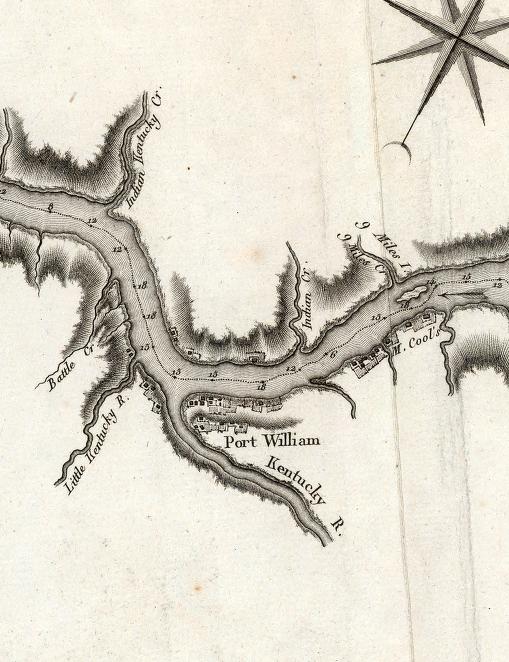
1796. Former French General Victor Collot surveys American rivers on a secret mission. He mentions the Indian-Kentucky Creek by name and Battle Creek (modern Locust Creek in Carroll County). He left Pittsburgh on March 21

1797. George Ash settles in the Lamb area. Ash swears on January 29, 1802 that he has lived in Indiana on the land given him by the Indians for the last four years.

1797, June. Israel Ludlow begins surveying the Greenville Treaty line at its northern end.

1797/1798. Settlers from Nelson County, Ky., begin settling in Switzerland County.

1798, October 15. Jean Jacques Dufour begins buying land for his first vineyard on the Kentucky River.

1798, June 22. The area east of the Greenville Treaty line, including Switzerland County, becomes part of Hamilton County, Northwest Territory. Jefferson remains in Knox County.

1799, August 6. Jonathan McCarty appointed Justice of the Peace for Hamilton County, which then included Switzerland County.

1798, January 8. The territorial government reports about two hundred families have settled just west of the Great Miami River in what was then Knox County.

1799, July 23. Captain E. Kibbey finished 70 miles of a road from Vincennes to Cincinnati. The road will cross Jefferson and Switzerland Counties before 1805. Undocumented reports say it crossed Switzerland in 1801 or 1802.

1800, July 4. Indiana territorial government begins operating.

1800, December 3. Jonathan McCarty's daughter Lydia married Gershom Lee in Gallatin County, Ky.

1800, October 12. Polly Netherland married David Owen in Hamilton County, Northwest Territory. The transcription show the justice as Jonathan County, probably McCarty. This is the earliest known marriage recorded for Switzerland County. He also officiated at the marriage of his cousin Paul Froman to Kesiah Pickett in Hamilton County on November 13. All were known Switzerland County residents.

1801, February 3. Clark County created. It includes Jefferson County and the part of Switzerland County east of the treaty line.

1801, July 15. Gen. William Henry Harrison writes that Indians complain that whites cross the river in the fall on hunting expeditions from the mouth of the Kentucky to the Mississippi River.

1802, January 29. George Ash petitions Congress for rights to land granted him by the Shawnees.

1802, February 5. Shawnee Chief Black Hoof tells Thomas Jefferson the Indians want to give Ash a tract one-mile deep by four miles long, measuring from the mouth of the Indian-Kentuck Creek and down river.

1802, July 5. Heathcoat Pickett, who stayed in Switzerland County, and William and John Hall, who would move to Madison by 1807, are commissioned in the Indiana militia.

1802, May 1. Congress grants Dufour's vineyard company 2,500 acres in Switzerland County.

1802, October 5. As resident of Indiana, Captain William Hall and Gershom Lee sign a petition in support of Ash's land claim.

1803, January 24. Switzerland County east of the treaty line, Ohio, and Dearborn Counties become part of Clark County.

1803, March 7. Switzerland and Ohio County areas become part of newly created Dearborn County.

1804, December 30. Captain William Hall, Jonathan McCarty, and Gershom Lee sign another petition in support of Ash's land claims.

1810, November 23. Jefferson County created, extended east to Log Lick Creek.

1814, September 7. Switzerland County created.

Madison: 200 Years—Which 200 Years?

When Madison celebrates its bicentennial in 2009, it will be celebrating:

a. The date the first European settled in the town

b. The date the town was founded

c. The date when the first lots were sold

d. None of the above


The answer is “d.”

Madison’s bicentennial celebrates a rather odd date, which is the date the entrepreneurs, John Paul and his partners, acquired the land that would become the site of the city. That date, 1809, has nothing to do with actual settlement of the area or the creation of the city.

In fact, the question of who settled Madison—and which date could be considered its bicentennial—get tricky because there are different dates for when the first settlers reached modern Madison, which includes the hilltop, and old Madison, which didn’t.

Who first settled Madison? The answer is not simple.

The first settlers in the area comprised by modern Madison were Jesse Vawter and his family, who came to the area in the fall of 1806, settling on the headwaters of Crooked Creek, probably around the site of Fairmount Cemetery.

Then, there were settlers on the Ohio River who made their home in an area not in the original town laid out by Paul. These were the Halls, William, a Revolutionary War soldier, and his son John, who moved from the Lamb area to what would later briefly be the town of Fulton, an area just east of Ferry Street. Depending on the account, the Halls arrived in 1806, 1807 or 1808.

If the earlier dates are right, it was here the first building was constructed along the river. This was also the site of the first reported burial, in a graveyard near on the bank near the corner of Ferry Street, and where Jesse Vawter preached the first reported sermon in Jefferson County.

The first house built within the boundaries of Old Madison was built by John Wagner (or Waggoner) who landed at the foot of modern Jefferson Street on May 8 or May 10, 1808. He built a home on the site now occupied by the historic Scofield house

Paul, of course, acquired the property in the honored year, 1809, but the first sale of lots didn’t occur until February 1811, according to Jesse Vawter’s son John, who “cried out” the first sale.

At this time, Madison still wasn’t a self-governing municipality. In fact, the first known governmental unit in the county, Madison Township, was created in what was then Clark County. That was sometime before October 24, 1817 when a petition was signed urging the appointment of a justice of the peace.

Madison’s affairs were managed by the county commissioners, who established road districts for Madison on June 18, 1811. It was not until 1817 that the town had its own officers, with trustees elected on Sept. 8, 1817. Incorporation as a city didn’t happen until the 1830s.

In fact, there’s a “but” to be attached to the 1809 date. That was the year Paul, Lewis Davis and Jonathan Lyon first laid claim to the land. But they did not receive the actual patent for fractional sections 2 and 3 in Township 10N Range 3E, river front tract, until 1812 when the completed payment on the three-year plan then used for acquiring government land.

And through some error, the actual patent document wasn’t issued until 1952, part of a long process in the 1900s as the U.S. government corrected such oversights.